Clay Masterson, Backcountry Conditioning Expert & Gear Pragmatist
June 24, 2026 · 8 min read
Verifying PCT Water Reports Saved My SoCal Hike
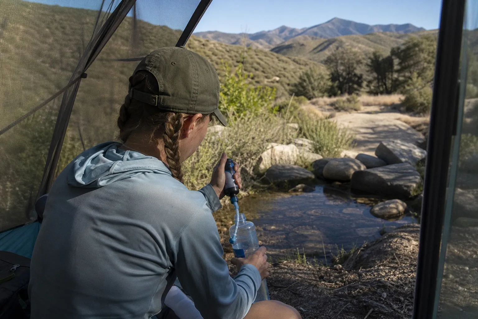
Seven hundred miles into the Pacific Crest Trail, my Sawyer Squeeze started sputtering. Filter clogged with silt from a stagnant cattle tank outside Hikertown. I had twenty-three miles to the next reported source and four liters of capacity.
That was the day I learned the hard way. Crowdsourced water data isn't gospel. It's triage.
Most hikers roll into Southern California with a 2018 guidebook and a prayer. Both will fail you. The PCT Water Report saved my hike that day because I had the data — but I also had the discipline to treat that data as a starting line, not a finish line. Here's the actual playbook.
The Reality of Dry Stretches: Why Guidebooks Fail in SoCal
Print guidebooks lie. Not always. But often enough to kill you.
The desert sections of the PCT — Section A into the San Jacintos, Section B across the Mojave, the climb out of Warner Springs — stretch 20+ miles between reliable water in late season. Snowmelt trickles die by June. Seasonal springs that flowed the previous spring turn to cracked mud by mid-July if the snowpack was thin. Your data has to be live data.
PCT guidebooks get revised every few years. Print media can't keep up. A water source listed as "reliable year-round" might not have flowed since March.
I've personally arrived at sources flagged in print as flowing and found tumbleweeds. Troughs baked white. Pipes dry above the valve. The mental math shifts immediately: how far to the next source, what's in my bottles, can I push another dry stretch if this one lied?
Stop trusting the paper. Start trusting the network.
Navigating the PCT Water Report Database for Real-Time Intel
The PCT Water Report is a crowdsourced database — hikers submit status updates on water sources: flowing, stagnant, dry, contaminated. Real-time intel from boots on the ground. No revision cycle. No editorial delay. The signal you need when guidebook data has already rotted.
Here's the operating protocol:
1. Filter by section. Southern California splits into discrete subsections. Don't browse the whole map. Drill into Section A, Section B, or the San Felipe Hills specifically. Mile-marker filters are your friend — match the data to where you're actually walking tomorrow.
2. Sort by recency. A report from three days ago beats a guidebook any day. A report from yesterday beats that. Anything older than 72 hours in late July is anecdotal at best.
3. Read the comments. "Flowing but silty" tells you more than "flowing." A green status with a comment about a dead cow nearby tells you more than ten green status dots.
4. Screenshot at the trailhead. Cell signal dies somewhere north of Mount Laguna. Cache the relevant subsections before you lose reception. Your report data should live offline by mile 100.
Use the report like a weather forecast. It's probabilistic. It's directional. It's the best signal you have, but it's still a sample of one hiker's observation. Crowd consensus smooths out the variance — it doesn't eliminate it.
If your water report is older than 72 hours in SoCal between June and September, assume the worst. Then plan for worse.
That rule has never failed me.
Beyond the Report: Balancing Crowdsourced Data with Contingency Planning
Crowdsourced doesn't mean certified. Every system that leans on user-generated content faces the same signal-to-noise problem. The PCT is no different. A green status from two hikers last week doesn't guarantee the source will be flowing when you arrive. Wind dried it out. Snowpack was low. Cattle fouled it. Spring channels shifted. The list of contingencies is long. Don't trust solo reports with your kidneys.
Build the backup before you build the plan:
- Carry capacity for the worst case. If the report shows 18 miles between sources, don't carry just enough for 18. Carry for 25. The half-liter you save isn't worth the half-day you spend crawling out of a dehydration crater if that report lied.
- Cache water where it's legal. Some bail-out towns and trail angels host jugs at junctions. Pre-stage if your itinerary loops. If you're flipping around a closed section, that's your margin.
- Pre-mark highway bail-outs. Most dry sections have a paved road within ten miles — Highway 74, Highway 111, the I-8 corridor. Plot them on your map before you leave town. You don't want to be making geography decisions at noon with empty bottles.
- Track weather windows. A late-season atmospheric river refills trickles. A heat wave empties them. The report is a snapshot. Weather is the movie. Cross-check NWS forecasts before committing to a long carry.
I treat every water report as one vote in a larger poll. Real-time intel beats static data, but live observation beats both. Slow down. Look at the ground. If the spring channel is dry two hundred yards uphill, the source is dry too. Your eyes don't lie when the database might.
Essential Purification Protocols for Stagnant and Flowing Sources
Treat everything. No exceptions. No "it's flowing clear, I'll take my chances." No "I filled up yesterday and I'm good for a few hours." No exceptions.
Giardia, Cryptosporidium, E. coli, norovirus — these aren't hypothetical threats on the PCT. They're waiting in stagnant stock tanks, in spring pools where cattle have been standing, in trickles seeping through cow pastures across the Tehachapi floor. Documented outbreaks trace back to backcountry sources. This isn't folklore. It's epidemiology.
Your protocol depends on what you're carrying. Three primary methods work, and each has tradeoffs:
| Method | Mechanism | Carry Weight | Time Per Liter | Protozoa | Bacteria | Viruses |
|---|---|---|---|---|---|---|
| 0.1-micron hollow fiber filter (Sawyer Squeeze, Katadyn BeFree, Platypus QuickDraw) | Mechanical sieving | 2–3 oz | 1–2 min | Yes | Yes | No |
| Chemical purification (Aquatabs, Aquamira drops, chlorine dioxide) | Oxidation | 1–2 oz | 15 min – 4 hrs | Yes | Yes | Yes |
| UV light (SteriPEN, UV water bottles) | DNA disruption | 3–4 oz | 1–2 min | Yes | Yes | Yes |
| Boiling | Thermal kill | N/A | 5+ min | Yes | Yes | Yes |
The 0.1-micron hollow fiber filter is the workhorse. Pull it out at every flowing source. Pump. Two minutes per liter. Done.
But filters miss viruses. Tiny pathogens slip through sub-micron membranes. In the high Sierra, viral contamination from alpine trickles is rare. In SoCal stock-tank country, viral risk rises — cows shed crypto, runoff carries pathogens from grazing land. If your source is a trough or a cattle-accessible spring, layer chemical treatment after filtration. Drop a chlorine dioxide tablet in the clean bladder. Wait. Drink. Two layers of defense at the cost of a quarter ounce in your pack.
UV pens work fast but demand clear water. Silt blocks the light. Cloudy water needs pre-filtration through a bandana or your filter before the UV cycle means anything.
Boiling works. Always works. But fuel weight and time cost make it impractical for thru-hikers burning 25–30 miles a day. Save the stove for resupply towns.
Whatever you choose, commit to it. Don't stop filtering because the tank looks clear. Don't skip tablets because you filled up yesterday at a different source. The protocol is binary. Treat or don't drink. Half measures at a stagnant trough 23 miles from the next source is how people end up in the ER.
Managing Water Weight and Capacity for High-Risk Sections
Six pounds per gallon. That's the load.
Water is heavy. Hauling it grinds your knees, your hips, your cadence. Most hikers hit a ceiling around 4–5 liters of carry capacity — anything more and your trail economy collapses. Uphill pace drops 30%. Descents punish already-torque-loaded joints. Fatigue compounds the heavier the bottle load climbs.
But short-changing capacity in SoCal is suicide. The two errors you can make:
1. Under-carrying in a long stretch. Die slow.
2. Over-carrying and shredding your legs on descent. Die fast.
The math that keeps you alive in the dry sections:
- 4 liters minimum for any section with sources 15+ miles apart. Non-negotiable.
- 5–6 liters if the next report is older than five days, the stretch is pushing 20 miles, or temperatures are forecast above 95°F.
- Auxiliary capacity (a 2L collapsible bladder like an Evernew or CNOC) for the long hauls through the San Felipe Hills, across the Mojave floor, and over the climb out of Warner Springs toward Agua Caliente.
Don't optimize for weight. Optimize for margin. The half-liter you save by leaving your Platypus at home isn't worth the half-day you lose to dehydration if that report is wrong.
Capacity also drives pace planning. A 5-liter load demands slower downhills. Loaded joints under braking force compound — I've watched shredded quads on Highway 74 because Hiker X didn't account for eight pounds of water plus a 40-pound pack plus a slope pitched at 30 degrees. Braking mechanics break down fast. Patellar tendon takes the first hit, then IT band, then everything else follows.
Stop planning for the report. Plan for the worst-case version of the report.
Final Word
Crowdsourced water data saved my hike through Southern California. It also taught me to distrust the moment I started trusting it.
Run the report. Filter by section and recency. Cross-check multiple sources. Cache data offline before your signal dies. Bring capacity for the worst-case scenario. Treat every drop — flowing, stagnant, questionable. Don't negotiate with pathogens.
That's the protocol. No shortcut. No chip in your filter that reads sources for you. No gut feeling that substitutes for verified intel.
Haul the water. Run the logic. Stop making excuses.
— Clay